Client
Corio Generation
Asset
Sceirde Rocks Windfarm
Location
Irish Sea
Client challenge
Corio required an Integrated 3D Ground Model (IGM) to inform risks associated with WTG gravity-based foundation and cable installation for the Sceirde Rocks OWF. The site presented one of the most complex site conditions, characterised by sub-cropping and outcropping rock, steep slopes, and high lateral variability in the soil and bedrock units
A key challenge was the consideration of gravity-based foundations (GBS). These structures typically occupy a large seabed footprint and require strong, uniform soil conditions to ensure stability. Successful installation also depends on the ability to position a heavy-lift barge in proximity to each foundation. This made the precise identification of suitable soil pockets and accurate mapping of rock boundaries critical to the project’s success.
How we helped
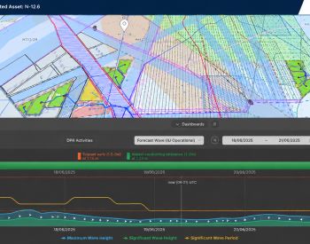
Vysus’ Survey & GeoEngineering (S&G) team integrated and interpreted all information available from public domain data, previous studies and geophysical and geotechnical data acquired within the array site and export cable route corridor.
A time-depth velocity model was established based on the geotechnical data collected during the SI campaign. The generated model enabled S&G to view high-resolution bathymetry, geological units as 3D surfaces and rendered volumes, and the proposed subsea infrastructure built to scale.
Successful Results
Precise foundation placement: Each WTG location was evaluated against soil pocket distribution to identify the most suitable sites for GBS installation and barge access.
Geohazard evaluation: A thorough assessment of potential geohazards that could affect the construction, operation, and long-term stability of the WTG and jack-up foundations.
Efficient installation design: The 3D model was used to calculate the stone bed volumes required beneath each foundation and the jack-up spudcans. This assessment also allowed for micro-siting on areas that would require significantly less bed volume.
Advanced geological insight: mapping of the lateral and vertical distribution of the units in a highly complex site, crucial for developing the IGM and for identifying soil provinces for engineering design.
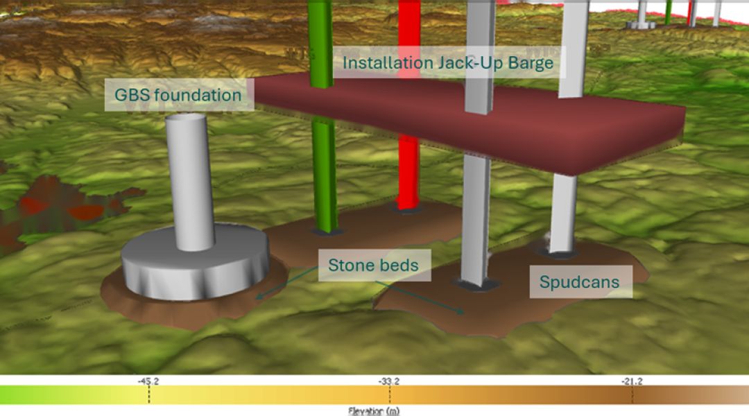
GBS, Jack-up and stone bed base case dimensions shown within the 3D ground model
Related Services